Precious Metals
Gold Mines in West Africa: Two Billion Years in the Making
THE GOLD HAS BEEN MINED FOR A THOUSAND YEARS. MOST OF THESE MINES ARE UNDER 25
The following content is sponsored by Galiano Gold


Four New Mines Since 2024: Lafigué, Kiaka, Ahafo North and Kiniero all reached production within eighteen months, in four countries.
Mined Since the Early Centuries AD: West Africa supplied the bulk of world production until Europeans reached the Americas.
Cover Is the Obstacle: A weathered regolith obscures near-surface gold signals across much of the region.
The nine West African countries with significant reported output produced about 15% of the world's mined gold in 2025, according to Metals Focus and World Gold Council data. Almost every mine on the map above was built in the past 25 years, and four more reached production in the last eighteen months: Lafigué in Côte d'Ivoire in June 2024, Kiaka in Burkina Faso in June 2025, Ahafo North in Ghana in October 2025 and Kiniero in Guinea in December 2025.
All of it on ground that has produced gold for a thousand years. The industry is new. The gold is not.
West Africa supplied the bulk of the world's gold from the early centuries AD until the European discovery of the Americas, according to a review of the region's goldfields in Episodes, the journal of the International Union of Geological Sciences. Three goldfields fed the caravan routes that carried it north across the Sahara: Bambuk, Buré and the Akan field.
Bambuk lay between the Senegal and Falémé rivers, the ground where Sadiola, Loulo-Gounkoto and Fekola now operate. Buré, opened in the eleventh or twelfth century on the upper Niger, lay in the region where the Siguiri mine operates today. The Akan field lay in the forests of what is now Ghana and Côte d'Ivoire, where the ten mines in the map's southeast corner now operate. Each was found the same way: where the gold-bearing belts break surface and the metal can be panned from rivers or dug from shallow workings.

Those belts are far older than anything that has been mined from them. The greenstone belts of the Man-Leo shield formed between 2250 and 2000 million years ago, and the gold came later, carried in hot fluids and dropped into fractures during three separate episodes of mountain building.
The middle one did most of the work. It lasted about 15 million years, a quarter as long as the first, and left most of the region's gold behind. What it built along the way was a structural architecture of orogen-parallel, deep-crustal shear zones, which is the pattern the mines still follow. Those shear zones run for hundreds of kilometres. Only a few stretches of them ever reached daylight.
The rest stayed hidden, and not because it lay especially deep. Large parts of West Africa are covered by a deep layer of weathered material, called regolith, that sits between the surface and the solid rock below.
A buried deposit usually leaves a trace at the surface. Small amounts of gold work their way up into the soil above it, so explorers sample soil across a grid and look for the patch where readings run slightly high. Where the regolith is thick, and where material has been washed in from somewhere else, that trace is diluted or displaced, and the readings stay flat over ground that holds gold. A 2024 review of gold mineralisation in Mali describes a complex, poorly understood regolith that obscures near-surface gold signals across much of West Africa, which is why soil geochemistry alone has found fewer high-quality deposits in recent years.
Comparable belts can therefore look very different at surface. Where the weathering and erosion history differs, the same rock can give a strong geochemical response in one district and almost nothing in another, which is a difference in detection rather than in prospectivity.
The same regolith that hides deposits from a soil sample makes the region suited to airborne geophysical surveys and deep geochemical sampling, the Episodes review notes. In western Mali, where laterite and silt cover is thick, researchers have used airborne electromagnetic data to map the shear and fault zones that host the gold, because the structures are legible from the air when the chemistry is not legible from the ground.
Lafigué, Kiaka, Ahafo North and Kiniero all reached production within eighteen months, on belts that have been worked since the eleventh century. What changed is not the gold. It is how much of it can be seen.

Galiano Gold Inc. (TSX: GAU) (NYSE American: GAU) is building momentum at the Asanko Gold Mine in Ghana, West Africa. With a strong, debt-free balance sheet, disciplined execution, and multiple operational and growth catalysts ahead, Galiano is focused on strengthening cash flow generation, growing Mineral Resources and Mineral Reserves, extending mine life, and delivering long-term shareholder value.
As a Canadian gold producer, Galiano is committed to responsible mining and sustainable value creation while contributing to Ghana's economic development through local employment, procurement, and community investment.
Learn more at www.galianogold.com.
MiningVisuals Disclaimer: This article is for informational purposes only and does not constitute financial or investment advice. Always conduct your own research.
Sources: Metals Focus and World Gold Council (gold production by country); Episodes (IUGS), West African Goldfields review; Masurel et al. (2022), Mineralium Deposita; Goldfarb, André-Mayer, Jowitt & Mudd (2017), Economic Geology 112; Kazapoe et al. (2024), Geology, Ecology, and Landscapes; Arhin et al., regolith mapping in northern Ghana; Minerals (MDPI), airborne electromagnetic survey, western Mali; Endeavour Mining (Lafigué); West African Resources (Kiaka); African Mining Market (Ahafo North); Robex Resources (Kiniero).

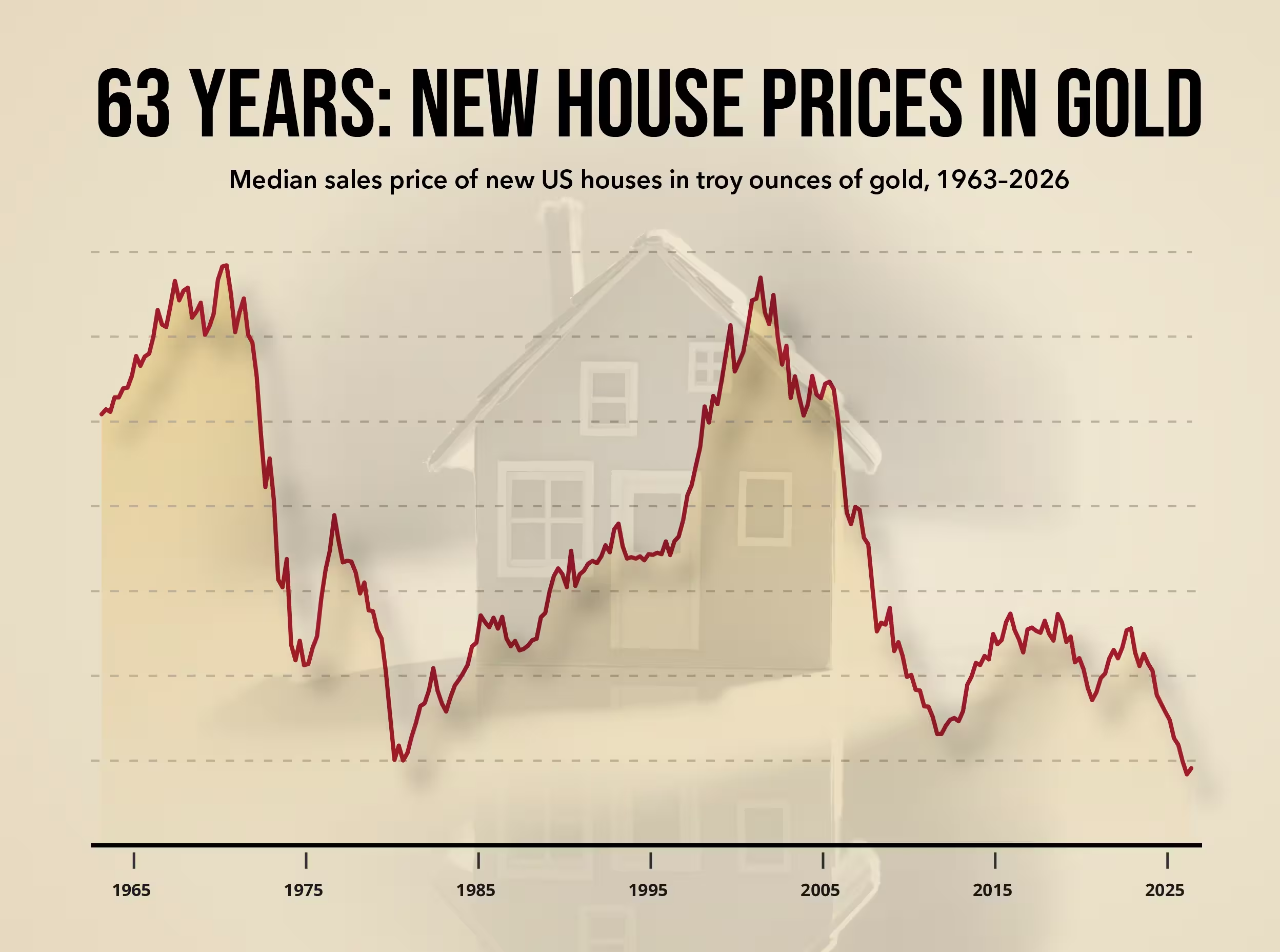
The US Census Bureau's July new-home report, released on August 25, put the median price of a newly built house at $393,800. HousingWire noted that was the lowest since July 2021. In dollars, the market has moved within a narrow band: the quarterly median has stayed between $408,500 and $435,400 since 2023.
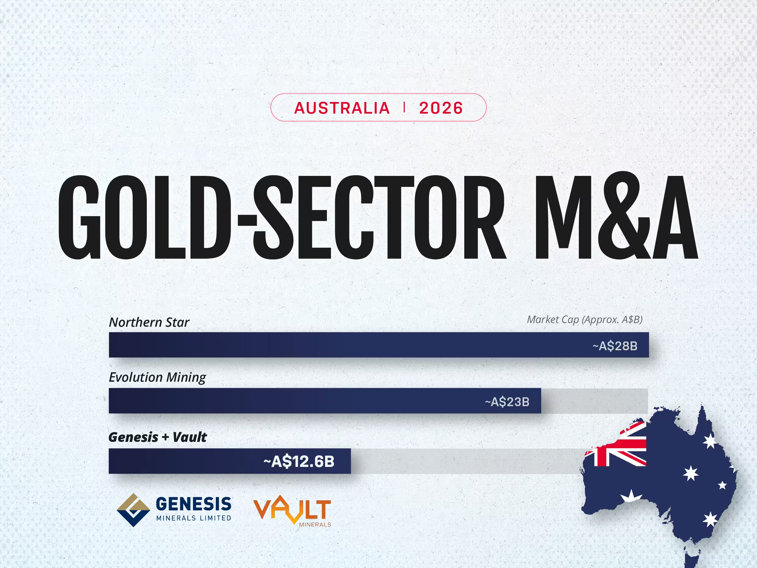
Gold hit an all-time high of about US$5,595 an ounce in January 2026 before settling near US$4,000, still far above the levels of a few years ago. That combination, record prices followed by a stable, still-profitable pullback, has done something a straight rally rarely does: it has opened a merger window.
.webp)
In March 2026, one of Ghana's own mining companies said it would invest about $1.2 billion in its operations at the Tarkwa and Damang gold mines. Both sit on the Ashanti belt, one of three narrow bands of ancient rock that carry almost all of Ghana's gold.
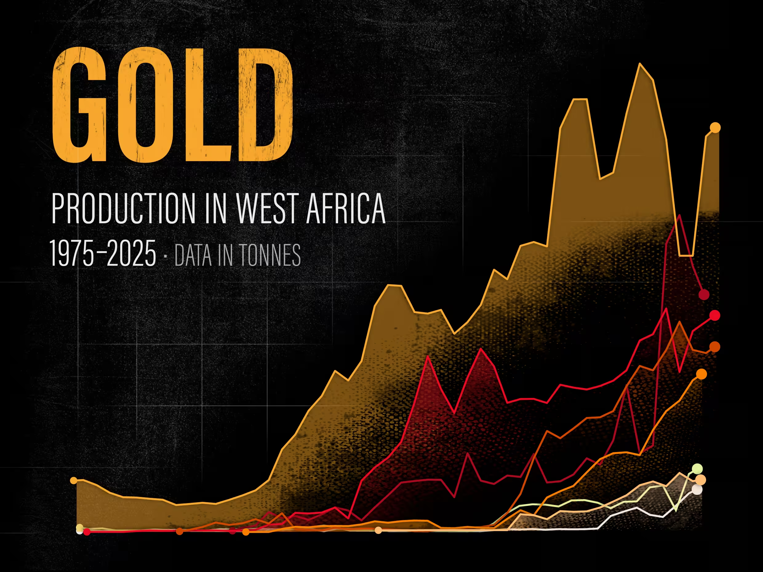
West Africa is in the middle of a gold run. In 2025 Ghana's output climbed more than 23 percent to a record 5.94 million ounces, holding its place as Africa's largest producer and now the sixth-largest in the world, and analysts expect the wider region to rebound about 8 percent in 2026.